Kalindikhal Pass Trek
Kalindikhal Pass Trek
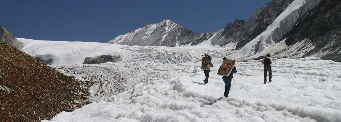
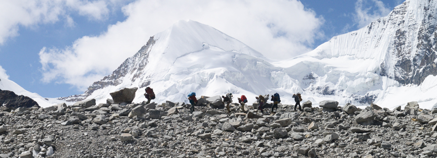
Set at an altitude of 5,947 meters, the Kalindikhal Pass on the base of Kalindi Peak, which is at an elevation of 6,102 meters, and surrounded by several other snow clad mountains is the world’s highest trekkable mountain pass. The journey en route Kalindikhal Pass unfolds some of the majestic peaks of the Indian Himalayan range. From the cluster of 6 thousanders, the Shivling at 6,543 meters, Meru at 6,630 meters, Kedar Dome at 6,808 meters, Bhagirathi I, II and III at 6,512 meters, 6,454 meters and 6,856 meter respectively, Nilkantha at 6,506 meters, Chandra Parvat at 6,728 meters and Avalanche Peak at 6,413 meters are some of the prominent ones along the trek to Kalindikhal Pass. From the group of 7 thousanders, the Mt. Kamet at 7,756 meters, Mt. Mana at 7,272 meters and Abi Gamin at 7,355 meters are visible during a bright sunny day. Further, the trail cuts through several small gushing streams and passes through the alpine meadows and forest enriched with wide range of Himalayan trees and varied species of Himalayan animals and birds. Finally a steep climb leads to dangerous glaciers, which are above 5,000 meters in height like the Suryala Bamak and Sweta. The trek to Kalindikhal Pass also covers some of the high altitude lakes of India, the Vasuki Tal at 4,800 meters approximately and Arwa Tal at 3,910 meters. The Kalindikhal Pass trek, which is one of the toughest treks in the Indian Himalayan belt, located in the Garhwal Himalaya, requires acclimatization and prior high altitude trekking experience. Most of the trail goes through a thick bed of snow and cuts through several glaciated and narrow tracks. The trek involves the use of ice axe, crampons and fixed rope and thus it is one of the adventurous journeys in the Garhwal Himalayan region.
The Kalindikhal Pass trek commences from the Bhagirathi Valley, from an altitude of 3,048 meters at Gangotri, which is one of the major Hindu pilgrimage sites. From Gangotri the trail leads to Bhojbasa, which is at an elevation of 3,792 meters, cutting through a thick alpine bed dotted with wide range of Himalayan trees. Thereafter the trail snakes through the rocky terrain to reach Gaumukh at 3,890 meters. Gaumukh is the mouth of the Gangotri Glacier and the origin point of River Ganga. From Gaumukh the trail winds upward to Tapovan, one of the high altitude meadows at an elevation of 4,463 meters and is a picture perfect campsite with the Bhagirathi group of peaks at the backdrop with crisscrossed bubbling streams and dotted with wild flowers.
18 Days